 Loading... Please wait...
Categories
New Products
Product Description
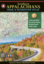
The result of over two years of field-checking and cartographic work, this large format 144-page book illustrates the diverse terrain and public lands of the Southern Appalachians from Harpers Ferry in the northeast to Springer Mountain and the Little River Canyon in the southwest.
The Benchmark Maps team has been field-checking and mapping the American West since 1995. Our Road & Recreation Atlases for 13 western states showcase the varied landscapes and vast public lands from the Pacific Coast to the Rocky Mountains, from Texas and the deserts of the Southwest to the tundra and fjords of Alaska. In 2018, we turned our attention eastward and began work on the Southern Appalachians Road & Recreation Atlas. Departing from the usual margins defined by state boundaries, we combined portions of ten states to establish the project’s scope. Thousands of miles were then driven through the region, visiting national & state parks, noting various points of interest, and interviewing local public land management agencies. From front to back, this new atlas brings a fresh and comprehensive view of the Southern Appalachians and the extensive recreation opportunities found in and around the mountains.
Recreation Guide (36 pages)
- Public Land Maps and Categorized Recreation Listings
- Blue Ridge Parkway with elevation profiles and attractions by mile marker
- Great Smoky Mountain National Park
- Shenandoah National Park
- Climate Graphs with Monthly Temp & Precip. Averages
- Information Resources with Contact Details
- POI Categories include Nat'l & State Parks, Forests & Wildlife Areas, Boating & Fishing Access, Natural Wonders & Trails, OHV Areas, Historic Sites & Museums, Other Attractions, Campgrounds, RV Parks, and more...
Landscape Maps (88 pages)
- Land Cover with Public Land Boundaries
- Point Elevations on Towns, Lakes, Peaks, etc.
- Multiple road classifications including: Interstates, Toll roads, Divided highways, Paved roads, Unpaved roads, and Four-wheel-drive roads
- Attractions and Recreation Access
Map Scales:
- Landscape Maps 1:190,080 or 1" = 3 miles
- Recreation Maps 1: 760,320 or 1" = 12 miles
- Blue Ridge Parkway 1:360,000 or 1" = 5.7 miles
- Great Smoky Mountains NP 1:253,440 or 1" = 4 miles
- Shenandoah NP 1:348,480 or 1" = 5.5 miles


