 Loading... Please wait...
Categories
New Products


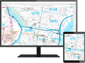


Phoenix Metropolitan Street Atlas 40th Edition

Product Description
WAS 54.95 NOW 49.99 TAKING ORDERS NOW FREE SHIPPING IN STOCK NOW
OVER thirty-seven years this atlas has been the people's choice for its quality and up-to-date information on the Phoenix Metropolitan Area. ts full-color maps, indexed listings, and fold-out map are professionally prepared with digital clarity. Each detailed street map covers a full township with the section numbers and ZIP Codes clearly indicated. The alphabetical street index designates city, block number, grid location, and page number. Current city boundaries, lakes, schools, hospitals, libraries, parks, golf courses, major shopping centers, and lightrail are clearly identified. Many customers with fleets of vehicles tell us that even though they have GPS or use on-line and internet mapping they still want every vehicle to have one of these street atlases in it. One such customer explains: "When we can't find what we need on our GPS I know it will be in the yellow map book."
OVER thirty-seven years this atlas has been the people's choice for its quality and up-to-date information on the Phoenix Metropolitan Area. I

Product Reviews
-
Great map book!

Posted by Sandy on 29th Aug 2022
Needed this to navigate around Phoenix area for medical reasons. Have had numerous Thomas Maps books for different cities nationwide and they are the best.
-
Not what I was expecting - disappointed.

Posted by Unknown on 4th Jan 2022
I was hoping for a simpler map of the area in a protected coating for frequent use in an easy folded format - color coded for easier marking of the different areas.This was far too detailed and in small presentation.
-
Awesome product
Posted by Gloria on 30th Nov 2021
I love to purchase these beautiful, up to date, professionally done street atlas. They are up to date on any new loops or interstates that have been added. Very easy to use.
-
Very small print map

Posted by Elizabeth Maricich on 16th Jan 2017
In order for me to be able to use it. I will have to go out and buy a page magnifier. With 3.75 reading glasses in sunlight I can barely make out the street names. I will need a page magnifier and glasses to read with good light. There are a few larger maps within but not in areas of need. So I'm a bit disappointed.