Loading... Please wait...
Categories
New Products


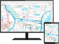


Sacramento, CA CUSTOM 2025 ATLAS

Product Description
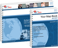
This Sacramento, California Map Book Premium Style includes: 2025 EDITION
The Premium Style Sacramento California Map is a reference map for businesses in need of comprehensive map detail. It has colored shading on populated areas and all points of interest are labeled including bodies of water, parks airports and more. Premium Style is best suited for applications that benefit from both an attractive display and abundant reference information. They are great for decoration, reference, market analysis, site selection and more.
This map contains All Streets and all Interstate, US and State Highway details.
Premium Style Map Books of Sacramento give you the wall map detail you need with the convenience of a portable map book. Map Books can be accessed without the internet and taken anywhere on the go - great for driving, deliveries and travel.
- Interstate, US and State Highways
- State names and boundaries
- Major Streets
- Cities and Towns
- County names and boundaries
- 5 Digit Zip Codes
- Zip Code index with grid locator
- Populated Places Shaded
- Airport
- Parks
- Golf Courses
- Institutions
- Misc Land Use (cemetery)
- All water boundaries